


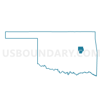
Voting District 34, Okmulgee County, Oklahoma
About
Outline

Summary
| Unique Area Identifier | 654872 |
| Name | Voting District 34 |
| County | Okmulgee County |
| State | Oklahoma |
| Area (square miles) | 35.05 |
| Land Area (square miles) | 34.81 |
| Water Area (square miles) | 0.23 |
| % of Land Area | 99.33 |
| % of Water Area | 0.67 |
| Latitude of the Internal Point | 35.69143440 |
| Longtitude of the Internal Point | -95.75991460 |
Maps


Graphs
Select a template below for downloading or customizing gragh for Voting District 34, Okmulgee County, Oklahoma


Neighbors
Neighoring Voting District (by Name) Neighboring Voting District on the Map
- Voting District 27, Okmulgee County, OK
- Voting District 28, Okmulgee County, OK
- Voting District 30, Okmulgee County, OK
- Voting District 33, Muskogee County, OK
- Voting District 37, Okmulgee County, OK
- Voting District 50, Muskogee County, OK
Top 10 Neighboring County Subdivision (by Population) Neighboring County Subdivision on the Map
- Morris CCD, Okmulgee County, OK (3,879)
- Haskell CCD, Muskogee County, OK (3,625)
- Boynton CCD, Muskogee County, OK (974)
Top 10 Neighboring Elementary School District (by Population) Neighboring Elementary School District on the Map
Top 10 Neighboring Unified School District (by Population) Neighboring Unified School District on the Map
- Morris Public Schools, OK (4,474)
- Haskell Public Schools, OK (4,470)
- Boynton Public Schools, OK (2,920)